Shira Route
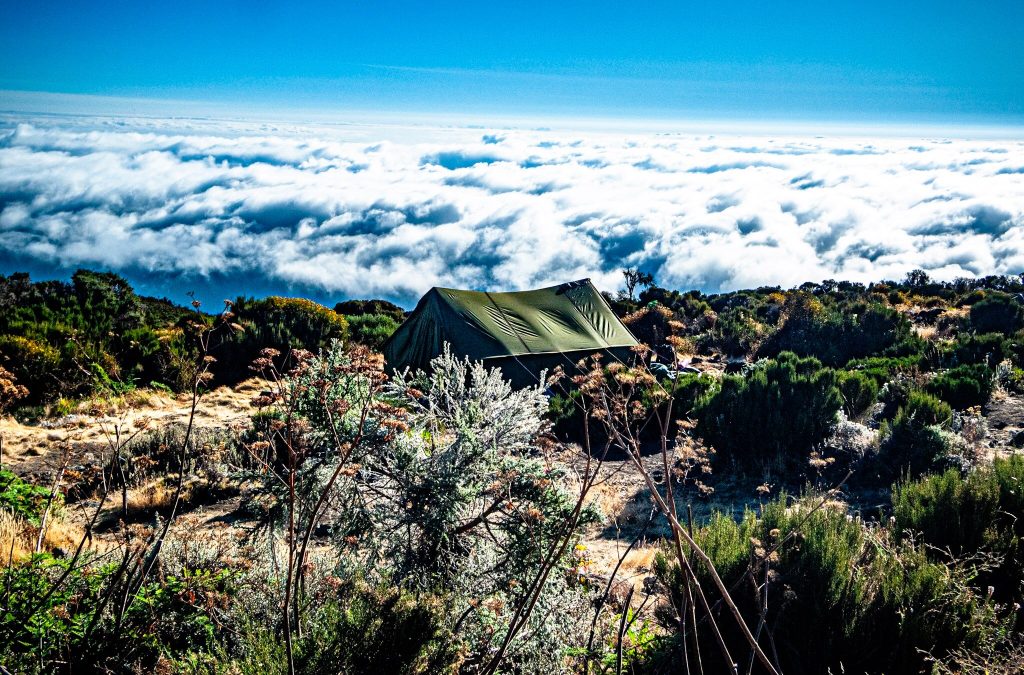
The Shira Route is a seven or eight day camping trek up Mount Kilimanjaro that begins with a vehicle transfer to the Morum Barrier at around 3,500 metres on the western side, skipping the rainforest entirely and stepping straight onto the Shira Plateau. Roughly one percent of climbers use it. Shira shares most of its path with Lemosho inside Kilimanjaro National Park in northern Tanzania and descends via Mweka.
Shira Route Trekking and How It Differs from Lemosho
Shira route trekking is the older of the two western trails. Lemosho was created later precisely because Shira starts too high, and knowing that one fact tells you almost everything about how these two routes compare.
Above the plateau they are effectively the same trek. Both cross the Shira Plateau, both merge with the Machame trail near Lava Tower, both take the Southern Circuit through Barranco and Karanga to Barafu, and both come down Mweka. The difference is entirely in the first day or two.
Lemosho walks in from Londorossi Gate at 2,250 metres through western forest, gaining height on foot. Shira drives you up a rough track to the Morum Barrier at around 3,500 metres and you begin walking from there. You save a day of trekking and you lose the forest, the gentle start and, more to the point, the night your body would have spent at a moderate altitude.
Sleeping above 3,500 metres on your first night is the opposite of what acclimatisation guidance recommends. If you have not been high in the last few months, Lemosho gives you the same plateau, the same views and a considerably better first 48 hours for a modest amount more money.
Shira Trek Day One from the Morum Barrier
The morning goes on driving. From Moshi you head to Londorossi Gate for park formalities, two to four hours depending on conditions, then continue on a forest track up to the Morum Barrier on the western rim of the plateau at roughly 3,500 metres. Four wheel drive is required and in wet months the track can defeat vehicles, which occasionally means walking further than planned.
Then you step out and start walking on open ground at an altitude most trekkers do not reach until day three elsewhere. It is a short walk, often two or three hours across the plateau to Shira 1 Camp or straight to Shira 2 depending on the operator.
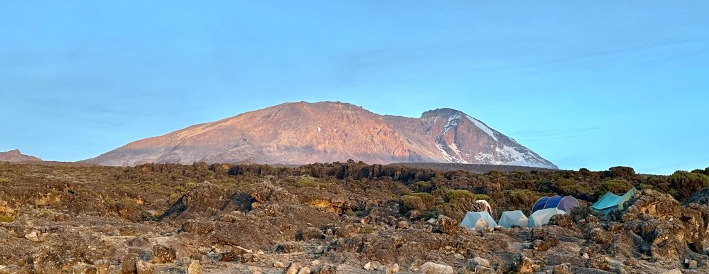
The immediate reward is genuine. There is no forest to walk through and no waiting for views. Kibo stands across the plateau from the moment you arrive, with the Shira Cathedral rock buttress at around 3,880 metres to the north and the plains falling away west. On a clear afternoon it is one of the finest first days available on the mountain.
The immediate cost is also genuine. Headaches on the first night are common here in a way they are not on the forest routes, and a poor first night sets the tone for several days.
Shira Route Trekking Across the Shira Plateau
The plateau is the reason to walk this trail. It is the collapsed remains of the third and oldest of Kilimanjaro’s three volcanic cones, roughly 13 kilometres across, sitting at around 3,500 to 3,900 metres. There is nothing else quite like it on the mountain: wide undulating high ground, giant groundsel scattered across it, and the bulk of Kibo filling the eastern horizon.
Days here are gentle walking with small height gains, moving east past the Shira Cathedral towards Shira 2 Camp at around 3,850 metres. Distances of eight to fourteen kilometres over four to six hours are typical, and the going is easy underfoot.
Better itineraries use the plateau days deliberately, taking an afternoon walk up towards the Lent Hills or detouring north to Moir Hut at roughly 4,200 metres for an acclimatisation night. If you are booking Shira, ask specifically whether Moir is in the plan. On a route that front loads altitude, that detour does real work.
Shira Trekking Past Lava Tower to Barranco Camp
From the plateau the trail turns south east and climbs towards Lava Tower, a volcanic plug standing at about 4,640 metres where Shira, Lemosho and climbers up from the busy Machame trail converge. From that high point the path descends into the Barranco Valley to camp at roughly 3,985 metres.
Seven to ten kilometres, four to six hours, and you finish the day lower than the highest point you touched. This is the first proper climb high and sleep low day the route offers, and it is the point at which Shira begins behaving like the good western trails.
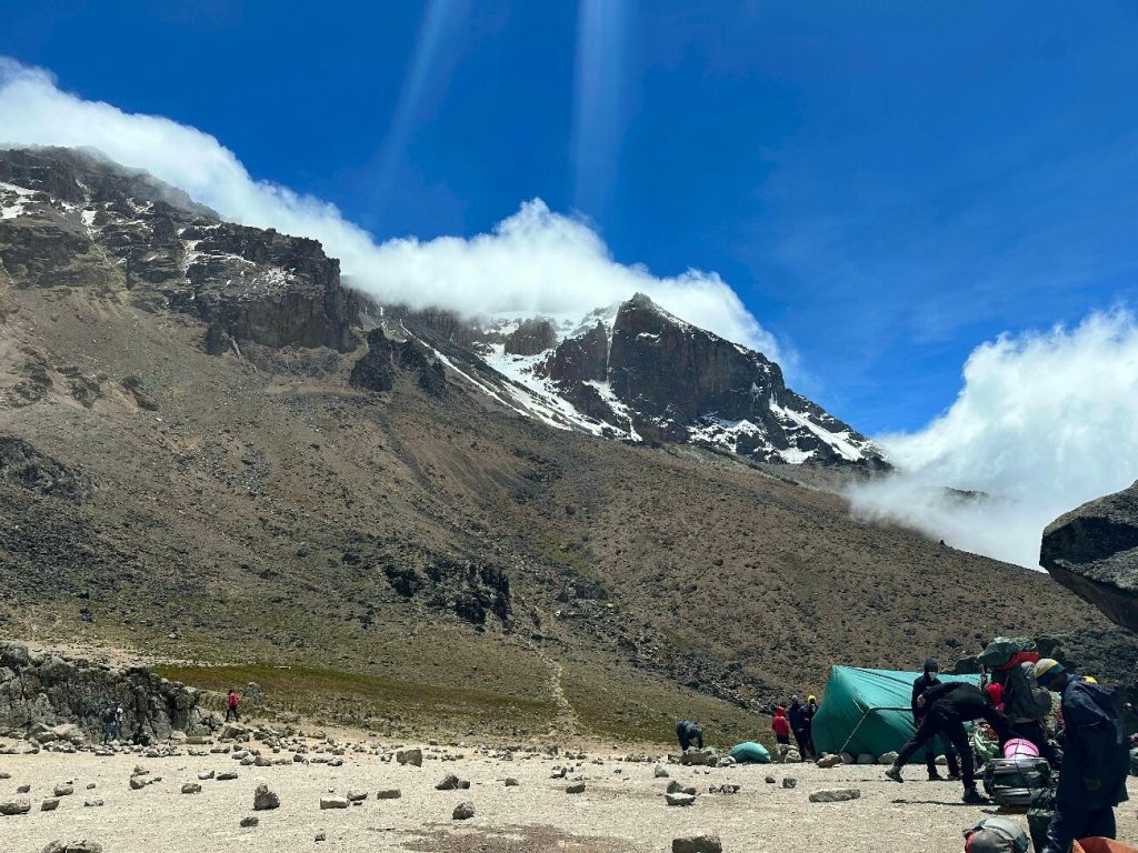
Barranco Camp sits in a bowl beneath the Breach Wall with the southern ice fields hanging overhead and giant senecio dotted across the slope. Above you, the wall you climb in the morning.
Shira Route Trekking Over the Barranco Wall
The wall is a 257 metre rock face and a scramble rather than a climb. An hour of switchbacks with hands on rock, no ropes, and a view from the top that puts you above the cloud with the summit clear ahead. Trekking poles go away before you start.
Beyond it the trail runs along ridges, drops steeply into the Karanga Valley and climbs back out to Karanga Camp at roughly 4,035 metres. Four hours, five or six kilometres, no net height gain. Some seven day Shira itineraries skip the Karanga night and push through to Barafu, which is the same false economy it is on Machame.
Shira Route Trekking to Barafu and the Summit Climb
A short steep pull through alpine desert brings you to Barafu Camp at roughly 4,670 metres by early afternoon. Barafu means ice. It is an exposed rocky ridge with wind most days, water freezing overnight and Mawenzi’s spires visible across the saddle.
Wake up comes around 11pm for a midnight start. Five kilometres of switchbacks on loose scree takes five to seven hours in the dark, with temperatures between roughly minus seven and minus twenty degrees Celsius before dawn and worse in wind.
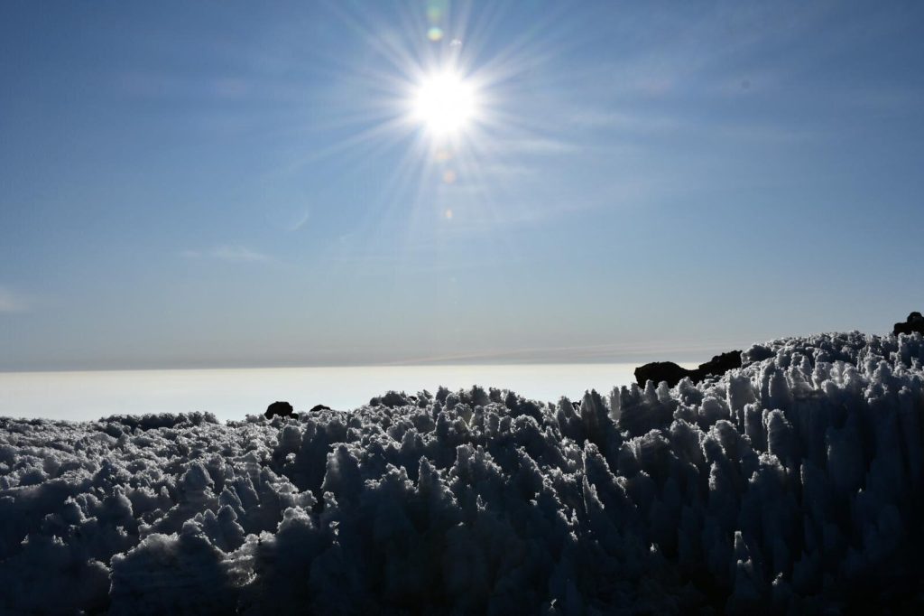
Shira trekkers reach the rim at Stella Point at about 5,750 metres, usually as the light comes up, then walk the crater edge for around an hour past the glaciers to Uhuru Peak at 5,895 metres. Down the scree to Barafu, a rest, then on to Mweka Camp at around 3,100 metres, with the whole day commonly running twelve to fourteen hours. A three to four hour walk out through the forest the next morning finishes at Mweka Gate.
The Shira Plateau is one of the great walking surfaces on Kilimanjaro. The argument against this route has never been about the scenery; it is about where you sleep on your first night.
Who Should Book a Shira Route Trek
Suits you if. You have slept above 3,500 metres in the last few months, know how you respond to altitude, and want big open scenery from the first hour without a day of forest walking.
Suits you if. You have a mobility or knee issue that makes the steep western forest descent into the plateau unappealing, and you would rather cover that section by vehicle. If it is comfort at night rather than gradient that concerns you, the eastern hut route is the only trail with beds.
Does not suit you if. This is your first trek at altitude. The first night at 3,500 metres or higher is where most of the trouble on this route begins.
Does not suit you if. You want the forest. Colobus monkeys, the big trees and the birdlife of the western slopes are all on Lemosho and entirely absent here.
Put simply, Shira is Lemosho with the best part of the acclimatisation removed and a vehicle transfer in its place. The only trail that asks more of an unprepared body is the steep southern ridge at Umbwe. Some operators quietly sell it as a shortened Lemosho, which is why it is worth reading exactly where day one of any western itinerary actually begins before you pay a deposit.
Best Time for a Shira Route Trek
January to early March brings warmer days, clear mornings across the plateau and often snow on the crater rim. Late June to October is the long dry season, colder at height but the most reliable weather, with July and August busiest on the shared Southern Circuit section and September quieter.
April and May are the long rains and this route has a particular problem with them: the forest track to the Morum Barrier becomes difficult or impassable for vehicles, which can turn your planned drive into an unplanned walk or force a change of trailhead. November into early December brings shorter rains with less disruption. The plateau camps are exposed, so wind matters here more than on sheltered forest routes in any month. If your dates fall in a wet stretch, the northern Rongai trail is the more dependable choice.
Getting to the Shira Trailhead
Fly into Kilimanjaro International Airport between Moshi and Arusha, about an hour from Moshi by road. Moshi is the base and the town where your briefing happens. Registration is at Londorossi Gate two to four hours away, then the track up to the Morum Barrier, so day one is largely a driving day even though you gain a great deal of altitude in it.
Plan a night in Moshi before the briefing and a night after your descent at Mweka Gate. Sleeping bags rated well below freezing, down jackets, poles and gaiters can all be rented in town. Given how exposed the plateau camps are, a warmer bag than you think you need is money well spent on this route.
Frequently Asked Questions About the Shira Route
How much does a Shira route trek cost?
A seven or eight day Shira generally runs $2,100 to $3,200 per person with a mid range operator, priced close to Lemosho of the same length. Some operators quote it slightly cheaper because one walking day is replaced by a vehicle transfer, though the four wheel drive to the Morum Barrier carries its own cost. Flights, the visa at around $50, high altitude insurance, tips and personal gear are extra.
What park fees apply on the Shira route?
Conservation fees of roughly $70 per person per day, camping fees near $50 per person per night, a one off rescue fee about $20, and small park entry charges for each guide, porter and cook. Most published tariffs exclude the 18 percent VAT. Because Shira usually runs a day shorter than a full eight day Lemosho, the fixed park bill is modestly lower, which is where most of the price difference between the two comes from.
Is Shira the same as the Lemosho route?
Not quite, though they share everything above the plateau. Lemosho starts on foot at Londorossi Gate at 2,250 metres and walks up through the western forest over two days. Shira drives you to the Morum Barrier at around 3,500 metres and starts there. From Shira 2 Camp onwards the two routes are identical, including Lava Tower, Barranco, Karanga, Barafu and the Mweka descent.
Why does starting high increase altitude sickness risk?
Because your body needs time at moderate altitude before it copes well with thin air, and sleeping altitude matters more than daytime highs. Beginning your first night at 3,500 metres or above skips the stage the forest routes use to prepare you. Guidance for high altitude trekking generally favours gradual gain, which is exactly what a vehicle transfer to the plateau removes.
How much should I tip on a Shira trek?
Around $300 to $350 per climber for a seven or eight day trek, scaled to crew size. Pooled across the group rather than paid per climber, the usual daily figures are $20 to $25 for the lead guide, $10 to $15 for assistant guides and the cook, and $5 to $10 for each porter. Bring clean US dollar notes from home, since cards do not work on the mountain.
Can I add Moir Hut to a Shira itinerary?
Yes, and you should ask for it. Detouring north from the plateau to Moir Hut at roughly 4,200 metres adds an acclimatisation night with a walk up the Lent Hills, which partly offsets the high start. Not every operator includes it by default on Shira, so raise it before you book rather than after.
Booking Your Kilimanjaro Trip
The safari companies and tour operators listed on this website put trips like this together for a living and know which camps, guides and routes actually deliver. We are an independent guide to Kilimanjaro; we do not book or sell tours ourselves.
When you are ready, arrange your safari, tour or holiday with one of the recognised operators listed here. Tell them your dates and what matters most, and a real person, not a form, will handle the itinerary, park bookings and logistics for you.